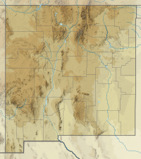
Mogollon Baldy
Appearance
| Mogollon Baldy | |
|---|---|
| Highest point | |
| Elevation | 10,774 ft (3,284 m) NAVD 88[1] |
| Prominence | 1,130 ft (340 m)[1] |
| Coordinates | 33°16′17″N 108°35′40″W / 33.271435958°N 108.594400561°W[2] |
| Geography | |
| Location | Catron County, New Mexico, U.S. |
| Parent range | Mogollon Mountains |
| Topo map | USGS Mogollon Baldy Peak |
Mogollon Baldy is one of the tallest mountains in the Mogollon Mountains of New Mexico in the United States. It is about 10,774 feet (3,284 m) tall. It is in the Gila National Forest and the Gila Wilderness. The summit marks the boundary between the Wilderness Ranger District and the Glenwood Ranger District.
This area was severely impacted by the Whitewater-Baldy Complex Fire of 2012 which was the largest wildfire in New Mexico state history.
References
[edit]- ^ a b "Mogollon Baldy, New Mexico". Peakbagger.com. Retrieved 2014-02-13.
- ^ "Mogollon". NGS Data Sheet. National Geodetic Survey, National Oceanic and Atmospheric Administration, United States Department of Commerce. Retrieved 2014-02-13.

